News
Applying Geographic Information Systems at Your Organization
November 16, 2023
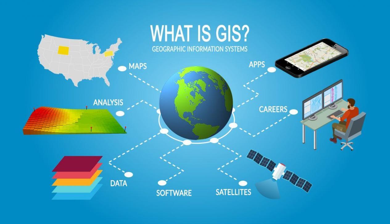
What is GIS?
GIS, or Geographic Information Systems, is a technology that enables the collection, management, analysis, and visualization of spatial or geographic data. Essentially, it’s a system that creates, manages, analyzes, and maps all types of data. GIS connects data to a map, integrating location data (where things are) with all types of descriptive information (what things are like there).
Here’s a breakdown of its key aspects:
- Data Collection and Management: GIS can gather data from various sources, including satellite imagery, surveys, and statistical information. This data often includes location information, like coordinates or addresses.
- Data Analysis: GIS allows for complex analysis of spatial relationships, patterns, and trends. For example, it can be used to identify the most efficient route for delivery services, analyze environmental impact, or track changes in land use over time.
- Mapping and Visualization: One of the most recognized features of GIS is its ability to create maps. These maps can be simple, showing just one kind of data, or complex, showing relationships among many different types of data.
- Applications Across Various Fields: GIS is used in numerous fields including urban planning, environmental science, resource management, transportation, public health, and emergency management. It helps in making decisions based on spatial information.
Want to improve your organization’s performance? Thrivence can help apply GIS to improve these areas:
- Data Visualization and Mapping: GIS allows organizations to visualize data in a geographic context, making it easier to understand complex relationships and patterns. Maps and spatial analyses can communicate information more effectively than traditional charts and tables.
- Decision Making and Strategic Planning: By analyzing geographic data, organizations can make better-informed decisions. For example, a retail business can use GIS to analyze demographic data and traffic patterns to determine the best locations for new stores.
- Asset Management: For organizations managing physical assets (like utilities or transportation networks), GIS is invaluable for tracking the location, condition, and status of these assets. This aids in maintenance planning, resource allocation, and efficiency optimization.
- Risk Management and Emergency Response: GIS can identify potential risks based on geographic data, such as flood zones or earthquake-prone areas. It’s also crucial for emergency response planning and real-time decision-making during crises, helping to allocate resources effectively and safely.
- Market Analysis and Customer Insights: Businesses can use GIS to analyze market trends and customer demographics. By understanding where customers live and their buying behaviors, businesses can tailor marketing strategies and improve customer engagement.
- Environmental Management and Conservation: GIS is used extensively in environmental monitoring and management. It helps in tracking changes in land use, monitoring environmental conditions, and planning conservation efforts.
GIS Data at Work
Click below to see the live maps.
- Challenger Deep – a story map by a master cartographer, John Nelson
- Global Wind Patterns – a live look at wind across the globe. Zoom in and around, it’s fun
- Live Satellite Tracking – so many satellites!
- Open Street Map – watch GIS data being created in near real-time all over the world